Why Does Southeast Austin Flood?
Ana Aguirre has admired the view along the Williamson Creek tributary — her so-called “mini greenbelt” — since she moved to her home in 1999. Every couple of years though, rain comes down in droves and builds up enough to cause damage to homes and families.
“‘98 was memorable,” Aguirre said. “2001 was memorable. 2013. Catastrophic. 2015. Catastrophic … And it seems like it happens almost every other year.”
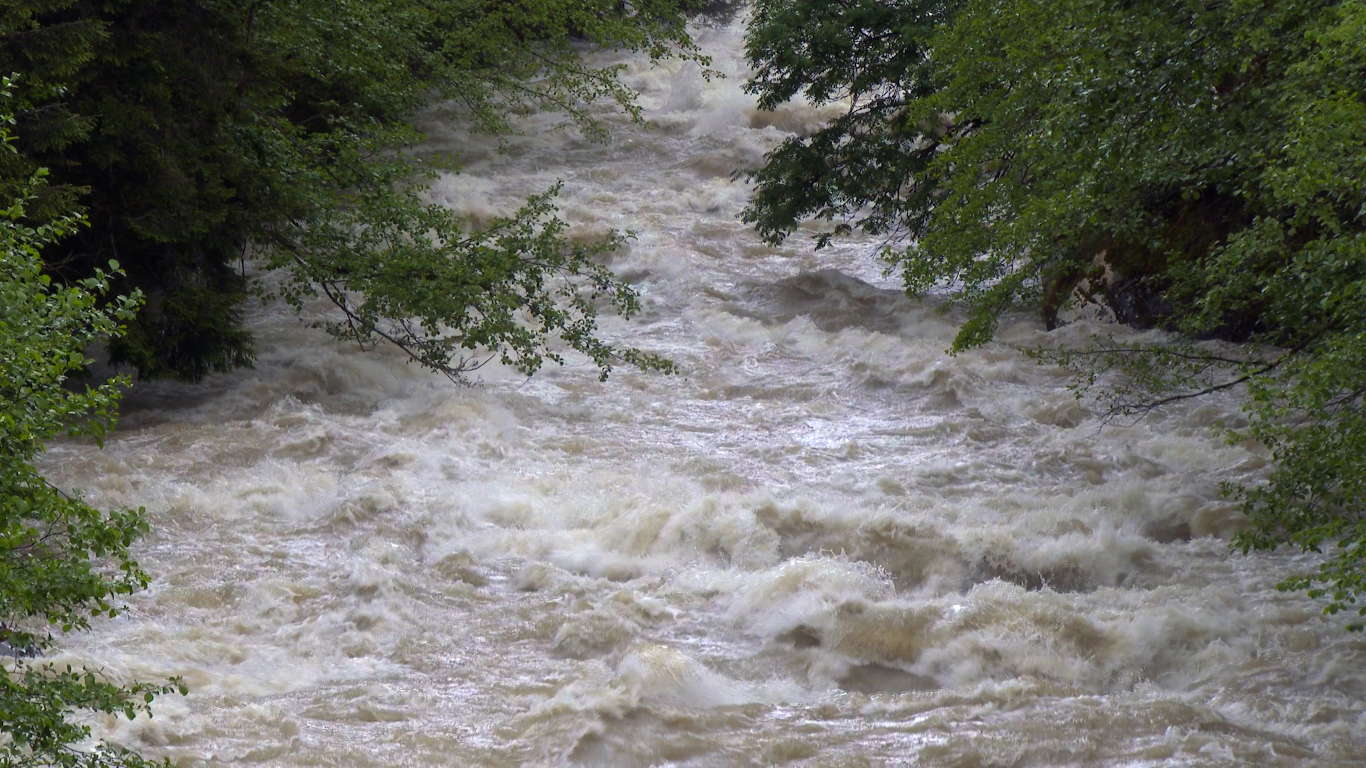
Flood waters rush through a creek bed. While all of Austin is susceptible to flooding, west Austin is more channelized and can contain more water than the eastern part of town.
The strip from Waco down to Uvalde is known as “Flash Flood Alley” because it has a higher flood risk compared to most of the country. All of Austin lies at risk of flooding. However, as the city’s largest watershed, rain in the Onion Creek area has brought trauma to some community members that lived through the historic 2013 and 2015 Halloween floods. Many lost their homes, and some lives were lost.
“The 2013 flood was extremely devastating to the degree that we had loss of life, and we knew people had to be moved out,” Aguirre said. “You're thinking this cannot possibly ever happen again. Then the 2015 flood happened with more devastation.”
Landscape and location are major factors when it comes to central Texas floods. Major storms from the Pacific Ocean and Gulf of Mexico, as well as strong frontal boundaries from the Great Plains coalesce over the area. Flood risks are also higher partly due to the area’s topography. Southeast Austin is a flat floodplain with very broad and wide land.
“In west Austin, the creeks in that area, because it becomes a little hilly, are generally very channelized,” Kevin Shunk, the City of Austin Floodplain Administrator, said. “It can stay within the channel.”
Water can access southeast Austin easier, compared to hilled locations such as west Austin, where water can easily distribute through different access points. In 2016, the city of Austin started buying out the homes that made it through the 2013 and 2015 floods to mitigate human risk for future floods. The old neighborhood is now Onion Creek Metropolitan Park.
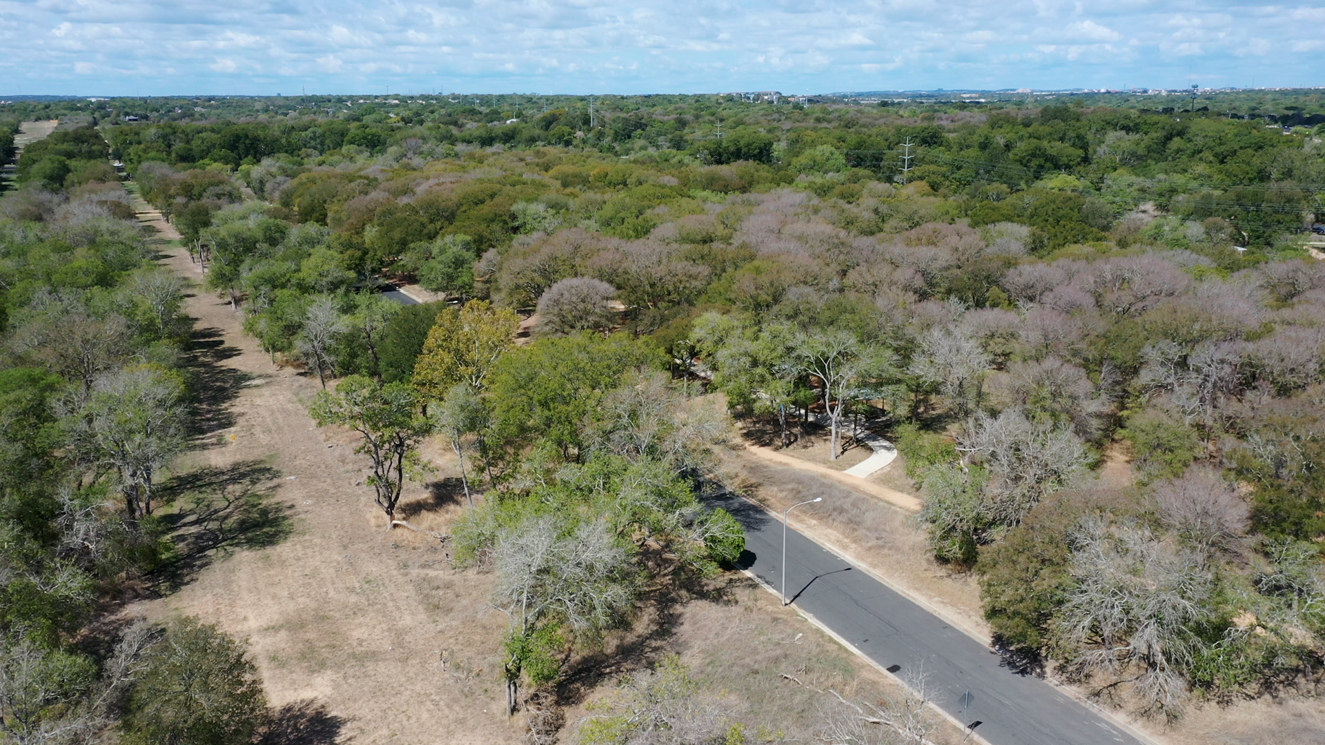
An aerial view of Onion Creek Metropolitan Park. The City of Austin bought out the homes in this former neighborhood after floods in 2013 and 2015. Visitors to the park can see gaps where houses used to be.
“When you have the lower Onion Creek community that was built in a floodplain, that should have never happened,” Aguirre said. “That's why we should have regulations.”
Except, regulations weren’t in effect until after the neighborhood’s construction. According to Reem Zoun, the director of the Flood Planning Division of the Texas Water Development Board, there were less regulations around flood mitigation before Congress passed the National Flood Insurance Program in 1968.
“We don't often realize that science is progressing with time,” Zoun said. “50 years ago, we didn't have floodplains in Austin. There was no criteria, so people did not need to adhere to anything.”
Most floodplain maps were created after the program started. It helped homeowners after a flood and required local municipalities to make their own flood mitigation laws to qualify for the program. Citywide regulations in Austin went into effect in 1983. But numerous homes in Dove Springs, including Aguirre's, were built before these regulations took effect. Now, Shunk said the city takes steps with construction sites to decrease flood risks.
“Development can't cause adverse flooding in other properties,” Shunk said. “They have to prove that before they can get a permit to build their development. That's one of the things the city does to ensure that all of this development that is happening isn't going to cause more flooding onto somebody else.”
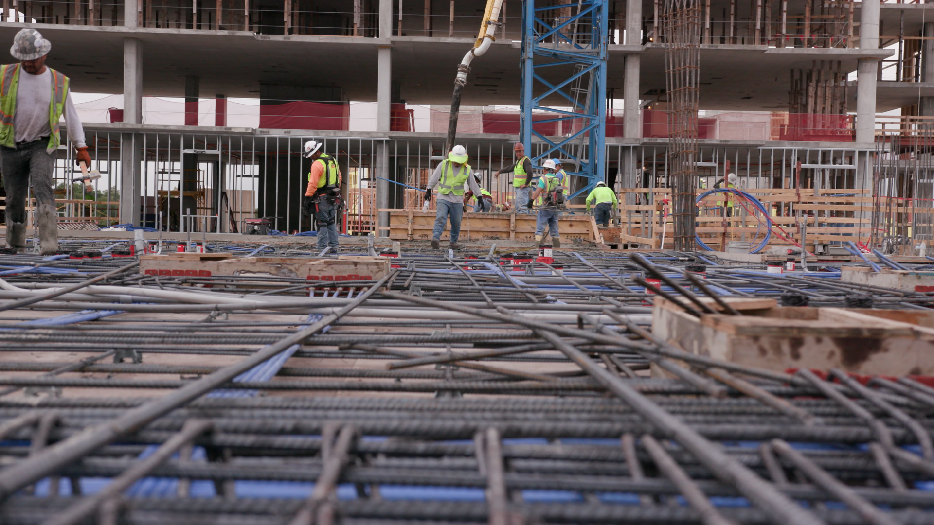
Construction workers walk across rebar. While there are now building ordinances meant to curb flood risks, many homes in southeast Austin were built before these rules went into effect.
Aside from creek overflow, another flooding hazard is localized flooding, which occurs when the city does not have the sufficient infrastructure to address the runoff. New data suggests these kinds of flooding incidents may happen more frequently.
“That's one thing we're really concerned about, is these very small, very intense rainfall storms that are very quick, that may flood in a very small area, but not flood the entire creek area … it could affect land and lots and neighborhoods and storm drain systems that are within that neighborhood,” Shunk said.
Atlas 14, a recent study of rainfall data, showed that Texas receives more rainfall than was originally expected. According to the study, what scientists used to consider a 500 year flood plain is now a 100 year floodplain. That means it’s five times more likely that a storm that could drop 13 inches of rain in 24 hours. However, Zoun said the state’s current drainage infrastructure isn’t large enough to handle Texas storms.
“15 regional planning groups throughout the state of Texas identified over 600 projects and the price tag of that over 600 projects is approximately $48 billion, 48 billion with a B, and this does not include all of the needs in the state,” Zoun said.
And experts are predicting that floods could become more intense over the years. In a recent report, the state climatologist predicted urban flooding events could increase by 10-15 percent compared to 2000-2018.
Austin’s Watershed Protection Department is preparing new floodplain maps that Shunk says will be finished in 2025. Zoun’s team is preparing a state flood plan to present to the state legislature next year.
“There is buy out,” Zoun said. “There is also elevating structures. There is creating larger storm drains, smaller infrastructures, but how about the areas where we haven't built yet? What can we do to make sure that we're not putting people in water this way?”
In the meantime, Aguirre is encouraging her neighbors to get flood insurance and continues to push developers and city officials to be mindful of construction projects.
“It's important to take care of the pieces that you cannot see,” Aguirre said. “That's what's underground and that's the foundation. It's kind of like building a home. If you don't have a solid foundation, then what's above it is going to be compromised.”
Community journalism doesn’t happen without community support.
Got story ideas, advice on how we can improve our reporting or just want to know more about what we do? Reach out to us at news@klru.org.
And if you value this type of reporting, then please consider making a donation to Austin PBS. Your gift makes the quality journalism done by the Decibel team possible. Thank you for your contribution.
More in Science & Technology :


See all Science & Technology posts

Contact Us
Email us at news@klru.org